The expertise
Connect surface insight.
Explore what lies below.
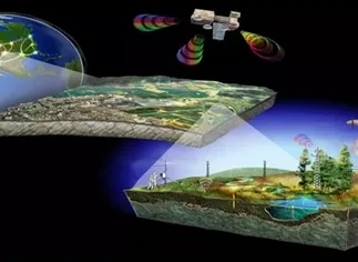
AGL combines remote sensing with geophysical and geological studies to build a clearer picture of the site and plan fieldwork efficiently, particularly across large licence areas.
Service 2 / 6
Remote sensing & geophysics
Our scope
How we support
your project.
01
Project data & remote sensing
We collect available project information and use satellite-based remote sensing as the starting point for planning field investigations.
02
Subsurface investigations
Georadar, induced polarisation (IP), resistivity and other appropriate methods help assess ore structures, mineral indications and alluvial thickness.
03
Targeted fieldwork
Geophysical findings are considered alongside geological studies to target further investigation and reduce unnecessary drilling and other costly work.
Working approach
Better information.
More focused fieldwork.
The preliminary studies guide how time and budget are used across the licence area.
At each project stage, AGL works with the project owner to select appropriate investigations, interpret the findings and address financial risk.
Your next phase
Start with
your project.
Share the available maps, previous studies and the questions your team needs to resolve so we can discuss the appropriate investigation scope.